Friday, June 1, 2012

Route: El Classico de 2012


  • Route: El Classico de 2012
Great ride with the El Classico personnel at the head of the effort and the meal following. 
'Chips, Scott, eat the chips. Have some salsa, as well!' Great idea. And the barbeque, gently savory spiced with all sorts of great stuff, three desserts. http://www.mapmyride.com/routes/view/94519369/?new_route=1


The route passes by The Good Times Restaurant near Outlet Rd. at the northern end of Ballston Lake. Then onto the infinite incline, on the downhill direction, north. Onto the shady Brownell Rd. Coolest piece of road in the hot sunny rides of 100 miles on June weekends. Van Areum then across I-87. Thence across the highway a couple of times until we circle the race course, through town, then out by Yaddo until we cross the highway AGAIN. Under construction it was a mess. Across on the other side, we climb the in-town climb. Onto Lake Rd. then across the river, looking longingly at the boathouse, and then right onto the horse country ride. Cool green of pasture land, thence through the fences, into the Alpine section. Up hills, working the gears loooowwww on the selection scale. Finally we come out next to the 32 access to the Battlefield monument. 32, 423, 75 then out onto 76 down to the lake. Saratoga Lake. We're only 12 miles from home. Up the hill, across until we return to Brownell, but the return is not complete without the semi-infinite shallow incline until we do Jonesville re-entry.

Out and Back with MeV


Find more Bike Ride in Schenectady, NY


Didn't have the time to or energy to do the entire 30 mile loop. So MEV and I went out as far as we thought prudent, turned around, went back to the office. 

DMika, Ti man, Juan Filkinos, myself -- the best team assembled. DMika was actually a little whacked the other day, according to one account, after doing some fast paced stuff. 

We did some good time on Riverview Rd. and really hammered it 26 mph . . . 30 mph.


Thursday, May 24, 2012

Sunday, May 20, 2012

Upper Gregg, because "everyone thinks it is gravel, but on Google Maps, I looked . . . not at all!

Sunday, today, May20, 2012, on the advice of the Ti Man, I go to find E. Gregg, to Upper Gregg, because "everyone thinks it is gravel, but on Google Maps, I looked . . . not at all!"
OK.
So here it is: 2 h 15 m for the following ratty route, including being stung on the face by a bee that managed to get inbetween my glasses and nose, http://www.mapmyride.com/routes/view/94507895


Find more Bike Ride in Schenectady, NY


Check out the Cat 3 climb portion. UGLY!!

AND to add insult to injury or the other way around, I got stung by a bee on my face (nose, really, but I don't want anyone making fun of my nose). This was 3/4 the way up so I was maximum sweaty and mildly insane with hypoxia, and couldn't see very well with perspiration dripping into my eyes and on my glasses from the bank on my helmet . . .

BLAMO!! A searing pain starts across my face and I rip my dark glasses (and regular glasses) off and nearly lose it all, but I hang on. I keep pedaling (up this 10% slope) and waving my glasses around, and finally put them back on . . . it HURTS, nose bridge piece rests on the sting site.

Then I get something blown into my left eye. Sting on nose near my right eye, something in my left eye, crap, what next!!??

Nothing.

I just go home, feeling vaguely sick from pedaling uphill for 1,900 ft, 60 km, in two hours, or so, in 88F temperatures.

Friday, November 25, 2011

Standard Ride-up-the-West-Glenville Hills escarpment . . .with a quick glance at the bridge under repair

It was a standard Ride-up-the-West-Glenville Hills escarpment . . .with a quick glance at the bridge under repair. T-bone and I left Nisky, ran through the town moves past Ellis, down Nott, through the back streets around Avneue B, then across the Freeman Bridge. . . to Sunnyside. Once on the other side of the tracks, and onto Cuthbert, Vley, etc. we spoke.

"So what do you want to do?" We couldn't decide but whipped past the turn off for Ridge and Rte 147. As we moved west on Rte 5 toward Amsterdam, we passed our options: Rector, Gower, and then decided to stop at the makeshift light next to the Stewarts Shops and look over the mounds of dirt to check out the repairs.

The repairs are on the by-pass (lock) that was washed away during the floods surrounding the Hurricane Irene and tropical storm that followed. Schoharie River valley got the worst of it. Entire villages were washed away, bad.

The route that crosses the river west of the town or in the town of Rotterdam Junction . . . on top of the falls or wier, and crosses over the lock for the Mohawk River . . . was washed away. They are dumping truck-loads of dirt. Thousands of cubic yards each day, I am sure, though I haven't counted. . . the Rte 5 lanes are messed up. Dusty. Dry. Orange cones are everywhere.

12 ft to go for the dirt/soil or fill to reach the road surface. Then they'll have to lay road bed, road surface, etc. check on the bridge structure (already done, I'm sure).

We pulled away from the wonderful sight and site, and moved east to Washout and started up the hill. We spent a good  15 minutes on the ride up, then down to Ridge. Left on Ridge after consulting an older couple out for a walk. The right on 147 toward town. The W. Glenville Rd. is  now repaired. They put in a culvert, repaved the road, another casualty of the monster rains.

It was getting colder and we went in and out of zones of warmer then cooler air as we moved along back toward town. Left on Bolt, right onto Swaggertown. Swaggertown until Van Buren raised the possbility of going across the Rexford Bridge. We surveyed the repairs to the underpass now being created and worked on. They uncovered the underpass stone work (which might just be cement). . . indicating the road went elsewhere or maybe there was another rail line . . . hard to imagine.

Cooler weather before too much longer.

Sunday, July 10, 2011

Down to the Mohawk at Cohoes and back, Saturday 9 July 2011

Down to the Mohawk at Cohoes and back, Saturday 9 July 2011
With T-bone, off we went for a little leg-stretching spin. . . once lunch was over and we were happy to be moving.


It's an easy route east on River Rd (Rosendale) around the 'S' and on past Lions Park to Old River Rd. to the Colonie town dump entrance, continuation of the Rail Trail -- you can do it in your sleep although it's not advised.
We deviate from the standard Route Nine Bridge loop by taking Fonda Rd. from the little cement plant on the east side of the culvert beneath Rte 9, and follow that east to the Mohawk R. Left or north on Crescent Rd. past the falls, the power generation site, the pool, with hint of the Lock Six park on the other side of the river, through the trees. 
Across the bridge, becomes the regular trail. We choose to climb the trail in the woods, once across the Rexford Bridge, then through the residential area (Olde Niskayuna, oh boy) to home. 
Nice ride and fairly OK time. 


Monday, May 30, 2011

A roll into Rensselaerville and return by 402, 143 and 85 + standard approach / return via Voorheesville

In a nutshell:


A roll into Rensselaerville and return by Routes 402, 143 and 85 and the remainder is classic approach/ return route through Voorheesville. [Two days ago, 5/28/2011, there was a parade or sidewalk sale Day. . . or Memorial Day on convenient Saturday venue.] Same route up to the Helderberg plateau but different route southerly, mostly, nearly into Catskill Territory. 


It started a nice cool, dry morning, after showers that had just ended when I left. Then, as the trip wore on, it became a little warm. By the half-way point, 55 km or so, arriving in Rensselaerville, I noticed I was low on liquids, drinking my way through my first bottle and a half or so, and hungrily scarfing down a snack. I stood outside the Catalpa B&B. 


The ride up the 85 / 443 route from the intersection with 85 & 443 there at the corner shop near Wolf Rd. was epic, as usual, and the flat + downhill was just as wild. I think I was hitting 60+ kph (so 40 mph) on the steady downhill from the Helderberg plateau down into R-ville. I saw some turkey, large pheasant, and a deer on one stretch of 85. When I finally pulled to a halt there at 351 and 85, I realized my time was getting away from me . . . I had 2 h 10 on the clock and I wasn't really headed north, at all, although my plan was to go  east somewhat.


So I make a quick revision, still stuck on whether to plunge into the soup and head east, way east to 32 or something, THEN go north -- but I stuck to a more prudent plan to go east on 351, the north on 402 into Westerlo. I hadn't been to Westerlo in a while, anyway. 


It's a pleasant trip; I'm always a bit surprised. I've photographed the library there on the corner at least three other occasions or two. 


So it was 143 straight north, YES, or continue on Route 1/Route 143 east-- maybe getting a terrain advantage. I stayed with 143 north, to join 85 at Somebody's Corners, a crossing I'd passed by earlier noting the descending price of gasoline 3.89/gal at the service station there. 


Up the hill on 85 a bit, not hard, not long until the downhill wheeeeee! free ride with wind in the chain. . . the front derailleur starting to give me grief. . . just when I needed the big chain ring in front for land speed record velocities. Past the Stewart's, stone place, on the flat to the Thacher Park turn off, past the big 'S' set of turns to 85A. 


In the other lanes, other direction, I saw some timid cyclists preparing to go up and they looking longingly at the descending maniac. I do the same. It wasn't long before I knew what time I might be home -- 1 pm. So I called then texted home. 


Saturday, May 28, 2011

GALLUPVILLE FROM HOME AND BACK ON 146

Leaving this morning around 9 am with plans and intentions for Schoharie County. I made it there and back, without getting hit with the rain that was a 'maybe' in the weather prognostications . . .

It didn't happen and I made it there.

From Niskayuna, the great unheralded secret path through to Voorheesville is to take Kings Road. You can cut through the northern end of Central Park, past the tennis courts, cross 7 at Golf Rd., dodge through the residences south of the Muni Golf Course, then cross State Street over to Roosevelt. Roosevelt runs straight into Albany Rd. turn left to the stop light 100 meters away. Bear right onto the Kings Highway or Kings Rd. (one of the earlier roads linking Albany to Schenectady) it now runs to Old State Rd.

Hang a right at Siver . . . there is a golf course and out or maintenance buildings at that corner 'Public Welcome' and believe me this morning there were 30 golfers improving their swings prior to taking on the long holiday weekend visit to the links. Pretty course. One half is on the other side of the road, so watch for 'em.

This to Willow Street, right to coast past the old school house, cross Rte 20, onto Foundry Rd. swing around keeping to the right at the first stop sign. Again into the woods to climb past an old quarry which is now a shooting range for a state agency of some stripe, up up up the hill to Grant Hill (even after Wormer) to get to Voorheesville.

In town there was a parade for a bit later, or just sidewalk sales, but I was able to escape the worst of the slow or blocked traffic.

Then up into the higher altitudes to New Salem, and the infamous right turn onto 85A -- The Helderberg Parkway or New Scotland Rd.

THE CLIMB!

How many times have we used this to get to Thacher? Scads. Tons.

But this time I was bent on continuing on 85 so onto the road rising to 85-443 and UP UP the nasty climb just past the Stewart's Shops on the corner of the 'T'. Brutal. But worth it once the trip down 443, the Helderberg Trail began. What a hoot. Never left the top chain ring in front. Really, a blast!

In no time, 20 or 30 mintues, I found myself in some funny little backwaters and quaint towns. Berne with its First Mill Road and then West Berne, then no berne at all, I was in Gallupville. Terrific houses, remnants from bygone eras. Stone silo on the way out of town easterly, yes, on 146. A must-see.

The long slow climb up to Altamont from Gallupville was nice. The road was in much better shape than 443 which near the end turned into a series of 'ka-bumps' as I tooled on down from the plateau down to East Berne. The winter's done its damage and the road crews haven't shown up yet.

Once in Altamont, it is easy to get home. Read the map; it's our standard return from Thacher Park route.


Or look here.

http://www.mapmyride.com/routes/view/35674174


Photo 1: The first mill site in Berne, sign next to the course of the stream of river, The Fox, near the Fox River Park. 
Photo 2: Gallupville on the uphill side, a quick snap of a beautiful old red brick home, original structure, augmented by the white wood sided portion in front.
Photo 3: Stone silo next to the red barn companion structure on 146 just as you enter the main intersection in town. 

Saturday, May 7, 2011

Trip up Johnson, whip past Charlton, around Ballston Lake, home by standard Ashdown Blue Barns Balltown Rd.

This morning was a perfect time for a trip up Johnson, whip past the village of Charlton, around the far end of Ballston Lake, then return home by the standard route from those parts: once out of the low-altitudes about the lake, up the hill Lake Rd. then Schauber Rd. past the Scribner house, to Ashdown,  Blue Barns, then Balltown Rd. south across the Rexford Bridge, up the trail,  through the residential area. . . home. Passing the Lake Farms apple stand, serving cider and apple cider doughnuts. Tempting.


Bright sunny day, even though it started out a bit cool at 60+ F, wind from the west carrying with it promised short-duration showers and ick. The weather map looked a bit threatening but most of the green and yellow was moving off to the north. The spots headed our way were moving west, steaming along, having us mildly worried. 

I was out in the yard tending to some mulching and putting down some composted matter from last year on this year's vegetable patch, when my cell buzzed and vibrated. "Starbucks is burning!" it read. "Need citizen volunteers. You qualified?" This had to be one of my riding buddies trying to get me off the land and into the saddle . . . SelleItalia, to be precise. We usually meet at the St. James Square Starbucks. Any excuse is good. I wasn't convinced that the store was actually on fire. 


I was up for it. T-bone wasn't up yet, so we'd travel light and fast. 

I was there at 10:30 am and we left soon after a quick route discussion. 

The route says it all. 1,000 fit climb after 15 or 20 km to get out to the base of the hill. Johnson can be daunting. Just as you turn off Route 5, the climb starts. Down shift to the middle chain ring in front. Click through the smaller to larger sprockets in back. I stay in the saddle and just climb the best I can. I'm doing OK until the third or fourth little ramp up and Ti man loses me. I try to keep up and only limit my time upright in the pedals to one stretch. Not bad! 


We crest in front of the house on the right, then start downhill for the flying turns (45 mph!!) that leave us breathless at the 'T' junction with W. Glenville. Left toward the corner with the church and fire station in the village. We rip down North Rd. and come to Rte 147 almost surprised. 'Where did this come from?' 


Jog right, then left, onto Charlton Rd. The westerly wind is now at our backs and on flat terrain I am cranking along at 30 mph! Not for long. The hills outside of town force me down a couple of gears and Ti man catches up and we take up a conversation from earlier. We agree to go on over to Outlet Rd on the north end of Ballston Lake, and take some route back. We are sailing and I'm getting a burn in the thighs from the pulls. We share and keep moving fast . . . 


We wrap it up by going past the lake's Rail Trail and taking Lake Rd. then Schauber up to the intersection with Round Lake Rd. near the apple cider/doughnut stand. Lakeview Farms or something. The sign says 'Doughnuts' 'Slab Bacon' I can't think of any combination of foods so revolting, even though I am beginning to get hungry. 


The return is familiar from here; it's a favorite at noon time with the group at work. But we go off trail into the residential area at St. Joseph and River Rd. 


Great ride. My legs feel 'worked' and we say good bye.

Sunday, May 1, 2011

Mariaville Lake by way of 160, return by 195, Crawford (descent)


Long climb up 160 from 5S from town. Glorious day and ripe for an early season climbing experience. 
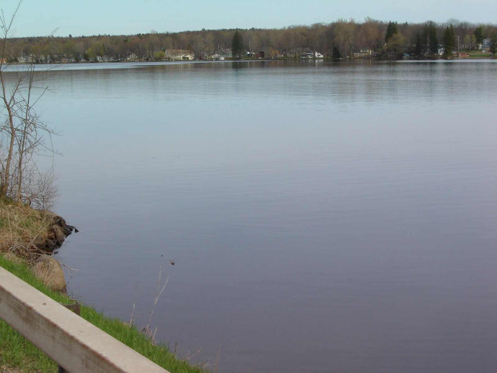
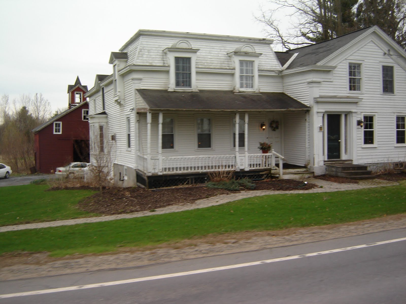
After 45 minutes we were in Pattersonville, then commenced the uphill work. It was hot on 160 and took a break on the way up, took a couple of snaps. Mariaville Lake is pictured above. One of the old homes on the lake's shores is the white structure above. According to the sign, James Frost built it in the 1834 from an earlier structure (built in the 1800 time frame, a Featherstonehaugh Mansion) . . . showing that reuse was always a part of proper stewardship of the resources at citizens' disposal. 

The intersection in the photo is where 160 meets 159 just uphill from the intersection with Dennison where it meets 160. We rolled down 159 heading east to return to town. We make it to the intersection with Rynex Corners road that heads north toward the river. We turn right at Crawford Rd., the higher altitude end, of course, and pass several antennae with 2 m and folded dipoles. A three element driven element, director and reflector, was seen. 

Down, down the hill. We squeak brakes all the way to the railroad overpass. I-90. We make quick work of returning to the Stockade from the rail trail and 5S. I phone home to leave a message that we will arrive before too much longer. Longest part was Nott in the traffic! Potholes and uneven pavement make it a challenge. We're home on time!  


Saturday, April 30, 2011

Charlton, west to Potter, then W Glenville and return


Gorgeous ride today almost 60 km at 65 F. With T-bone, phoned others, but no soap.
Juan did call back with regrets; one of his children was ready to go play a baseball game.

So we swept past the Starbucks; no one there. On we went through the residential area, down to the trail, through the woods, down down the hill and out onto Balltown next to the bridge. Scary, sometimes.

We snaked through Alplaus, then on Bruce to Hecheltown. Standard up to this . . . when we do the R then L,  to go north on Stage (including the L then R onto Stage, which T-bone missed, first try)
but no big deal. We tool along through Charlton, going west through town, outside of town, past the finer homes on the way to 147. We follow the inverse of the route used for the century rides; going R then L onto the road headed for the W Glenville corner.

We headed south once there, keeping an eye on the clock. We went along until Ridge Rd. offered a rolling hilly ride nothing boring like more or less flat 147. We start huffing it up the Ridge hill, curvey and wild when we take it the opposite direction. Hard to appreciate it at that moment. More up hill trekking. Then it evens out. We finally crest the hill, and crank it up to 30 mph, with no effort, all the way to Closson. We turn it down and go straight, keeping to the Ridge for the wild ride down to the Stewart's Shops.

Right back onto 147 through Beukendahl, left onto the Vly Rd., R onto Vly itself. We return the way we came except the bit going up Seneca through the residences of the Ave B neighborhood and all that.


Great ride.

Sunday, April 24, 2011

Charlton by Hecheltown, Indian Kill Preserve and return by Swaggertown Rd

Charlton by Hecheltown, Indian Kill Park and return by Swaggertown


T-bone was ready to roll by 10:30 am, having wakened an hour or two earlier and swallowed breakfast bagel. We saddled up me in my Battenkill jersey, he in his King of the Mountain Champion supermarket jersey from 12 years ago. We left Niskayuna by way of the Rexford Bridge, and turned left at the light to roll through Alplaus. Then right at the firehouse to approach Glenridge . . . L then R  onto one way Hecheltown, hence to the Indian Kill Nature Preserve, the old folks home, and the tiny homes from 50+ years ago along Hecheltown. 

Out onto Rte 50 is always daunting but not busy this Easter morning. So left then onto High Mills, which turns into Scotch Bush. . . but we take a L then R onto Lake Hill Rd which becomes Stage. Stage goes all the way into town. Charlton. Hardly 'town' . . . Historic Village is more like it. 

It's now starting to rain and we begin to regret leaving so late. We were warned by the early storm warning system, Gisele. 

On the way back, we just take Swaggertown all the way into Scotia-Glenville. We decide to take Van Buren over to Glenridge thence up and over past Maple to the rail overpass, pinched tight for single lane traffic. Turn right into Alplaus. Here we are an hour and some later. Return by way of rail trail, now clear of ice and snow, about time, up the hill to the cruise past the view of the Research Center's parking lot. Empty. 

I call ahead to let her know we're not far from home. JP may be in for lunch? Nope. Starting home from Long Island at 11 am, there is just about no way she can reach home by 1:30 pm. No. 

Great ride. 

Saturday, April 23, 2011

Cold, into the bracing wind, Van Vranken return by Droms


Sunday, April 17, 2011

Cool spring ride up Rector, return by Closson, Snake Hill, F'man Bridge

Cool spring ride up Rector, return by Closson, Snake Hill, Freeman Bridge 


Had a great idea to call the cycling dudes to see what was cookin'. One had yard duty. One had a flooded bathroom and they are selling the house. 

So T-bone and I  decided to go it alone. First idea was to do a Rte 9 Bridge Loop, but he did that last weekend when I was up in Cambridge, NY doing my thing on the back country roads of Washington County.


It was fun if not a little cool and windy. Hope the rest of the atmospheric disturbance will have passed once we start seriously riding next week. 
I consider the weather nice here, compared to upstate a little farther north -- snow, sleet!! 

Friday, April 8, 2011

http://www.mapmyride.com/routes/view/30708910

with jb, rjf, rc, and kw. As Always, a mixed bag of doing fast, easy, no-effort runs at up and down hills. We broke an aero-bar fitting up one hill near the Lakeside road stand selling cider doughnuts (later in the year) almost opposite the Scribner's old house . . .


Thursday, April 7, 2011

Ridge, Rector and Johnson on Lunch

It was epic.
I met Alicia on the way in to dress for the ride; then looked at the thermometer and smiled. Well above the normal 40 F I've seen before so many times. I almost left off the long sleeves, but thought better of it.
Out onto the open sunny road. Dry. Nothing in the way. Little traffic, even. I was having fun. . . and on my way!!


Standard way over Hillside, without the tearing wind, down the hill across the old Eric Canal, around the RR crossing to cross the Mohawk R. around the Sunnyside, Wash, then Cuthbert. And the turn off to Vly and whipping up onto 147 turning left at Stewart's Shops, climbing Ridge. Slow going but better than the last time, when I actually wheezed. Once on top, I veered left again to go down Rector past our North Carolina origined chemist, thence out onto the 5. 

Next stop: trip up the hill on Gower. It was the next one over, minimum of 5. What else?

Up Gower, with its wandering around was fun. I revisited in my mind the great flat tire moment of Michael. Whizzing along, I struggled up some standing, some uphill sections I sat down through the entire hike. I went to Sanders, to L onto Washout. All the way down. I am drinking a mouthful after each climb. Sailing down the wind and grade. 

I have to hoof it west to the next--Johnson. It's a pull and I end up at the top around 1:10. I'm back down at 1:13 and it's a slightly downwind trip on 5. Into Scotia, past Adirondack Bicycle, and it's closing in on the time for the training session, but I could care less. I'm cooking. The road is sailing past. I feel strong. 

That will change on Sunday, Battenkill day. 

Sunday, April 3, 2011

Dunsbach Ferry and return . . . T>50 F & Thomas' first for the season


Installation of odometer and tempo display, we togged up and got a start at 3:30 or so. Warm direct sun and diminished wind compared to earlier made for a nice start, but I put on the long sleeves anyway. Soon we were tooling down the street in our residential area on the way to fun. We wheeled through Edison Woods onto a familiar track . . . River Rd. We hit Rosendale, no one in sight, then on to the 'S' around to the straightaway toward the city park, then Old River Rd. 

Much less snow, ice and ick. Indeed, the rains have washed the surfaces clean of most everything that could wreck a bike or an outing. It's still bumpy out there on the bit from turn-off to Vly, to Fort's Ferry. We pass WTRY towers, the dip, then up the tiny hill to turn left to Shaker Bay. No water. The dry weather for the past few days has helped a lot. 

We do the Shaker Bay loop; then onto the route through the trees. . .. course right now, it's pretty brown and clear so you can see into the trees. 

Water treatment plant for Colonie on the left and right, so on to the gentle rise to the benches, dip to the road below, and encounter a family out for a ride. We zoom under the Twin Bridges (I-87) and right to go up the hill to Dunsbach Ferry . . . then to climb to the top, County View is not a misnomer; it's a great view in the winter. No leaves to get in the way. 

Return by the same route even down to the short cut. . . 

Nice 40 km ride. 

Saturday, April 2, 2011

Route 9 Bridge Loop with shortcut

I thought it was going to be nice with the cell rumbled away with "Ride this morning?" message from one of the regulars. 11 am, we decided, was a good launch time and Starbux the best place . . . and so off we go through Olde Niskayuna out onto Hillside into the teeth of some wind and fresh temps. The sun was out and hope was alive. . . but, my feet were cold at the end anyway!!

Across the escarpment on Banker, through the Community Center's parking lot, now devoid of snow pack and ice, some water inevitably since it rained a couple of nights ago . . fearing for the worst our garbage collectors sent a message NO PICKUP, the followed it with YES, PICKUP on Friday, yesterday. So they came; we had stowed everything.

Onto the Aqueduct raceway, thence the bridge everyone wants to replace with more lanes, and right onto Riverview. With some wind behind us we make time especially once past the village of Vischer Ferry. Juan says 'too fast' so we slow down a bit. Too fast is no fun!

We ride up and over the Northway, turn right onto Klamsteem, taking care at the bottom of the hill to turn hard, but turn slow in case of sand or gravel. Cranking in big chain ring in front, we whiz past some brown and limp vegetation trying to catch up with Ti man riding next to a civilian on a bike. We wind our way past the boat docks, the club back there, autos lining the road -- 10 of 'em -- some event.

The Route 9 bridge is windy, but not too bad, then up the hill. We decide to risk the Rail Trail under neath Route 9 in the culvert, an 8' diameter ripply thing and it works. Only one bad patch of ice and melting snow, compacted hard near Lock 7. We make it to the turn off to Rosendale.

Wheeling home eastward on River Rd. we take the shortcut through the residences in the area that opens up into Edison Woods. Ti man peels off south, I take my leave of Juan at Van Antwerp.

Juan answering my question 'why are my feet so cold', with 'It's not that warm!' One day this weather pattern will break and we'll have some riding climate.

Nothing like the race being run tomorrow http://rvv.be/nl/elite-men/race/track
Good luck!


Thursday, March 31, 2011

Ballston Lake Loop before the snow


Battenkill in 10 days . . . snow tomorrow. 2" to 4" snow for the Albany area, although 12" predicted in the mountains near Cambridge, NY, where it all starts. 

Sunday, March 27, 2011

Gower into the raking wind . . . and cold, too, did I mention cold?


Text on my phone at 10 am "Thinking of going out at 3:30" Later, after confirming I would go, "Starbucks 330". . . and that sealed it; I was doomed for more cycling into the wind and cold. 38 F or less, with even more wind than yesterday, if that would be possible. This route takes us up and over Hillside,, and I swear on that route, at that spot (top of the rise near the Army Reserve station) the wind is ALWAYS in your face. 

Hair-raising. 

or at least hair blowing. . . . 'course with winter riding gear, stocking cap, helmet, ear warming band, three layers of jerseys, wind block fluorescent lime green jacket, bib shorts, long pants, toe covers, criminey, socks even. 

It doesn't help. It's cold nonetheless. Blows you backward, it seems. So tearing up in one eye, feeling it in the finger tips, we press on. Down the hill, swerve left, onto Maxon Extension (nearly stopped by the Schenectady police for running the red light, that takes forever) to cross the bridge into the face of some wind down the Mohawk that surprised even me. 

Sunnyside was the 'into the wind' part that was heart-stopping in its length and flat . . . into the wind. Washington, around by the apartments. Lou is not far from where we pass. Cuthbert, on the other side of the lighted intersection, thence right onto Vly. Into the wind. 

Route  5 is no better, into the wind, and we dither about which hill to cllimb. Ti man doesn't want to commit to any climb, but  figures if we just do Rte 5 into Amsterdam, we'll die of boredom. Gower it is. 

Gower is one of the climbs up this escarpment that really has a mind of its own. We pass my entrances to 'palatial homes or some sort of installation' says Ti man, thinking back to a Google Globe search he did one day to figure out what is back behind the long driveways. Thence on to Sanders Preserve. There are even some trail  heads!! Charming. We'll come for a walk when there's less WIND. 

There is no real wind in the trees, but you can feel the cold. 

We wind up on the road we will take across Ridge to take Bolt all the way to Swaggertown. By then we've had enough. We didn't want to take on another thirty minutes of riding, so we turn right. For a change we take Van Buren so we end up on the Rexford Bridge on the way home. It's down Bolt and sections of Swagger town we find the moments to go 45 mph (72 kph) with a little help from the nasty wind. 

On into town and the familiar route up the hill through the Niskayuna Community Center, our favorite until the Rail Trail unencumbers itself of the snow and ice that's been there since the serious snow and ice began in January. We haven't seen it since then. 

Ti man peels off a Barcelona and Regent, to ride another day.