


So it's getting hot and humid, for the first time this season, it's around 80 by 10 am. I head out in the car with the bike stashed in the back. I don't want to do the commute via King's Road, it's a mess, bumping and icky, so I zip up to the Voorheesville town park just off the path headed up the hill to the Thacher State Park turn off.
New Salem is left in the dust at the base of the hill and I take on the climb up to 85 and Thacher Rd. turn off. I keep going. From here all along the approach to the 'T' with 443, one can see cuts in the road that shows off the shale. The sedimentary layers are open for all to see along the road cuts, and where the stream Onesquethaw cuts through.
http://www.mapmyride.com/route/us/ny/voorheesville/237127283759430278
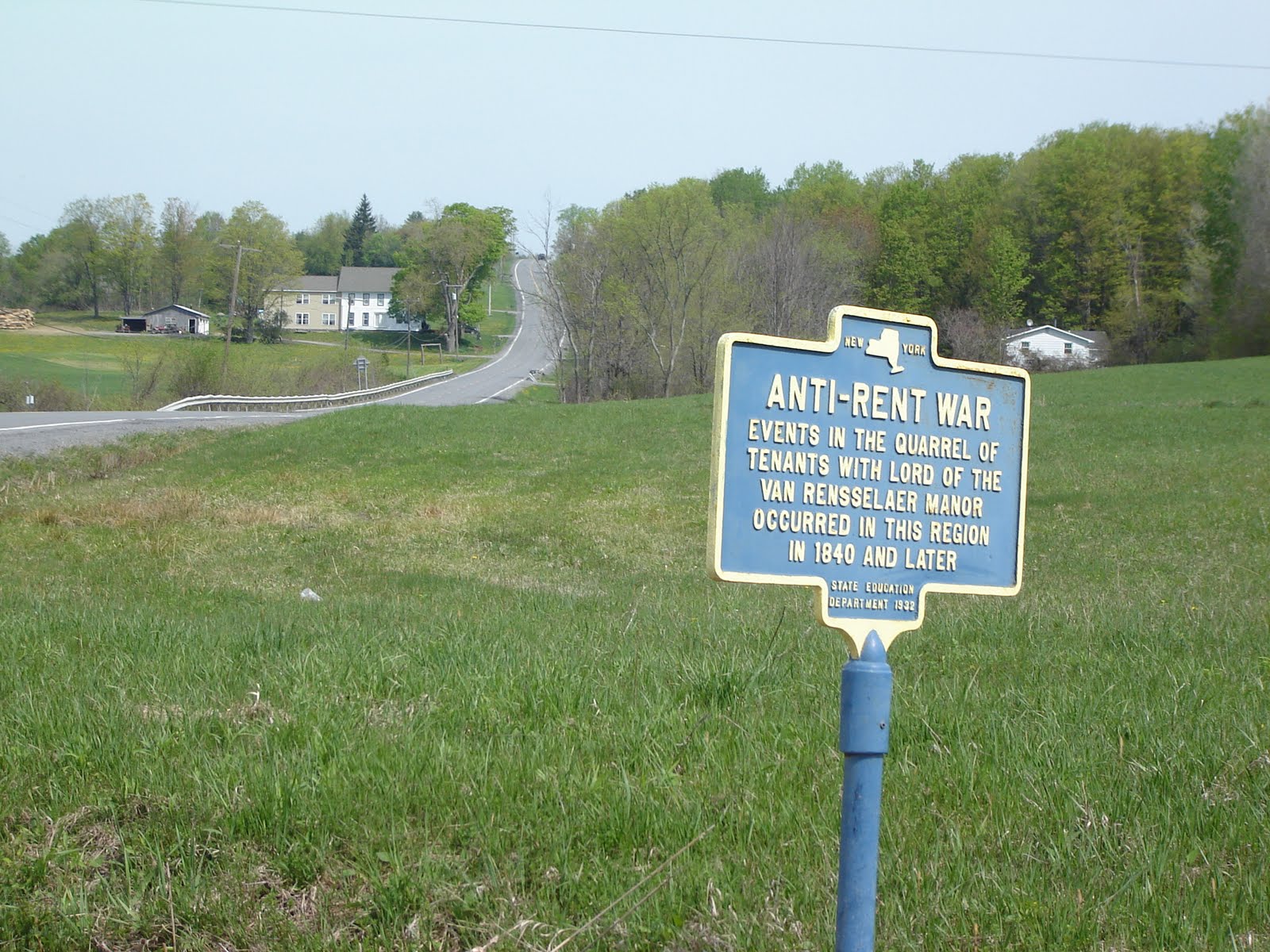
I continue climbing once past the Stewart's on the corner, following 443 and 85. Angle off on 85 and the climb peaks out at Co Rd 11 and the flat begins, then starts to drop. It's a note of hope that one day I'll finish. 45 minutes by this time. I come to the intersection with Route 1 or Switzkill and see the sign post for the Rent Wars.
History noted, I turn left or south and head down hill. I start looking for Westerlo. And got there! Quaint place. Public Library museum and post office on the corner with the main street and the route I was taking. http://www.townofwesterlony.com/museum.html
Onward on 143 south and east now with climbs and rollers. Fun. Just before Dormansville I see my turn off for 312 going north. It's getting late, as planned outing was to be 2 hours. It's 1 hour 10 or so, already. It's flat then a dip into the stream / valley, then up a hill. A long one. At the peak of the hill, Dunbar Hollow or Tower Rd. as in microwave tower hill top installation . . . I take a snap of the view to the north mostly toward Clarksville.
I look down at the odometer halfway down the hill: 80 kph!! Damn. 50 mph. I roll into the intersection with 443, turn left for a short stroll up to the Stewart's at the 85 intersection. Right and down the approach I just did uphill! toward Voorheesville (the town park is marked New Scotland Town park on the map).
Next trip, farther west to the Schoharie town and river valley, the return via Route 7 perhaps. Nice ride.


No comments:
Post a Comment